A large landslide occured at Kråkneset close to Alta on Wednesday 3rd June. Remote sensing data from Sentinel-2 shows clearly the size of the landslide. Images below shows the situation prior to and following the landslide as presented using the change detection tool offered by the Norwegian National Ground Segment for satellite data.
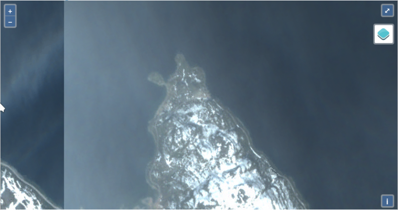
Image from June 1st 2020, prior to the landslide.
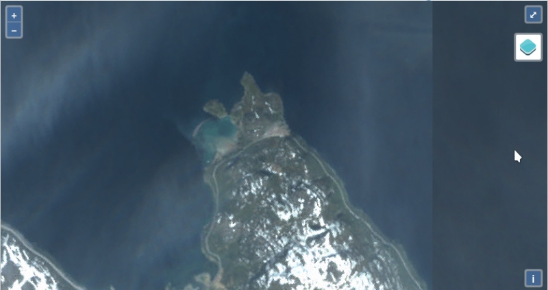
Image from June 5th 2020, after the landslide. The area shown reveals the area affected and sediments in the fjord.
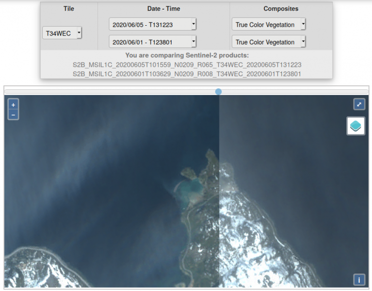
The Norwegian National Ground Segment for satellite data has a tool for change detection where two time steps for the same area can be compared. This situation is shown here. The user has to find the correct area in the fjord themselves and a screenshot of the service is presented below.
All images from National ground segment for satellite data are credited "Copernicus Sentinel data" and year, and that images are collected from the National ground segment for satellite data.